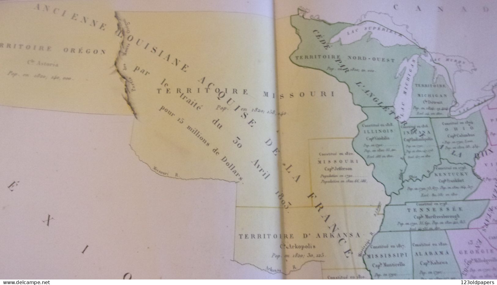
A fascinating publisher's proof of Buchon's important map of the Untied States, with an experimental coloring scheme and original editorial notes.
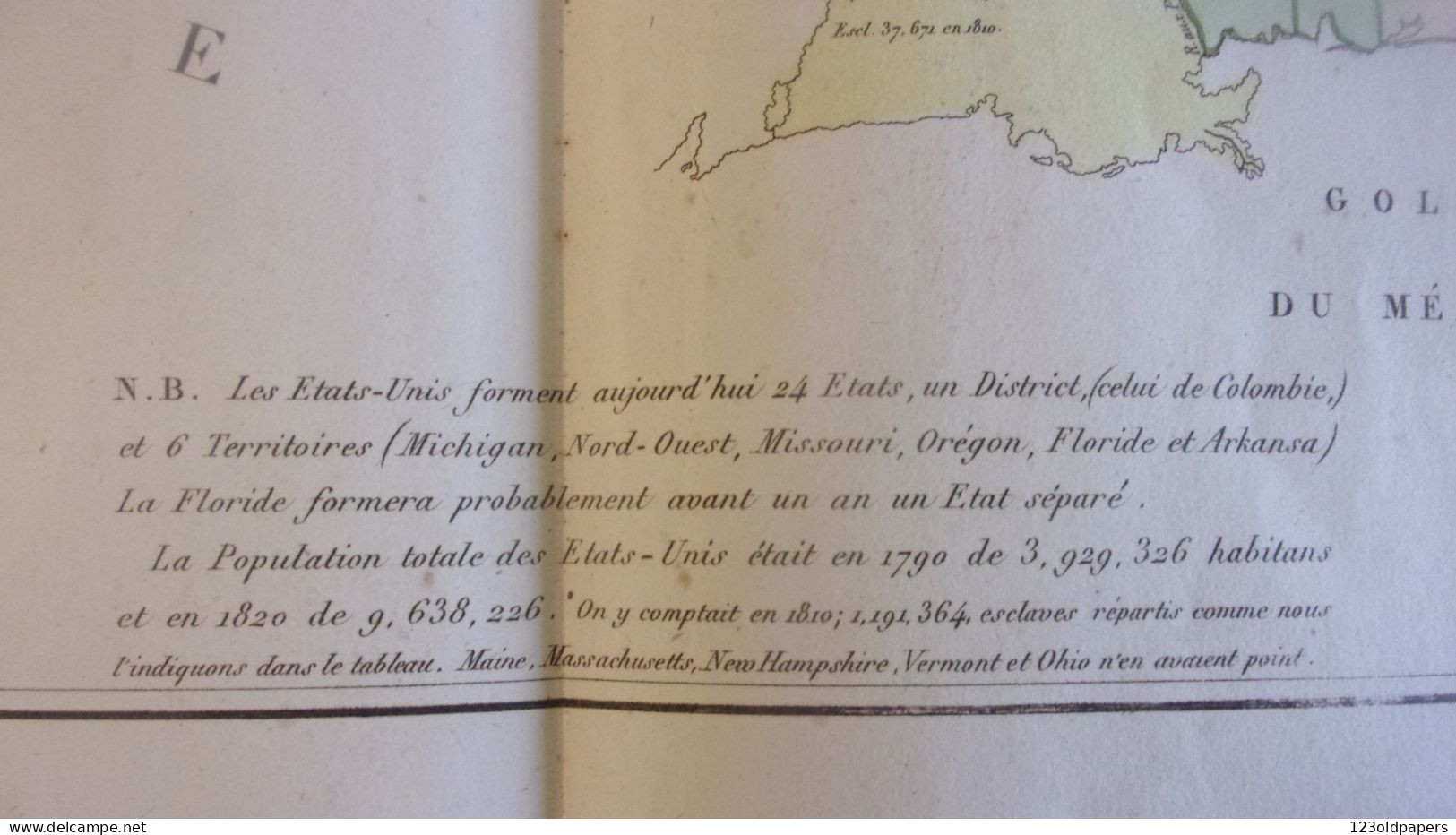
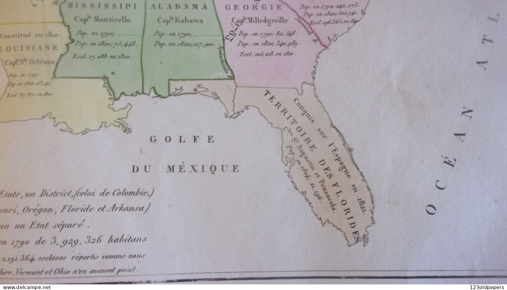
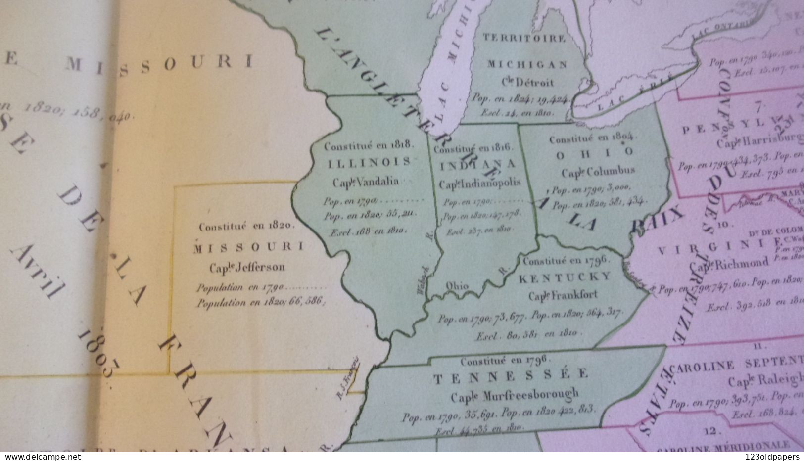
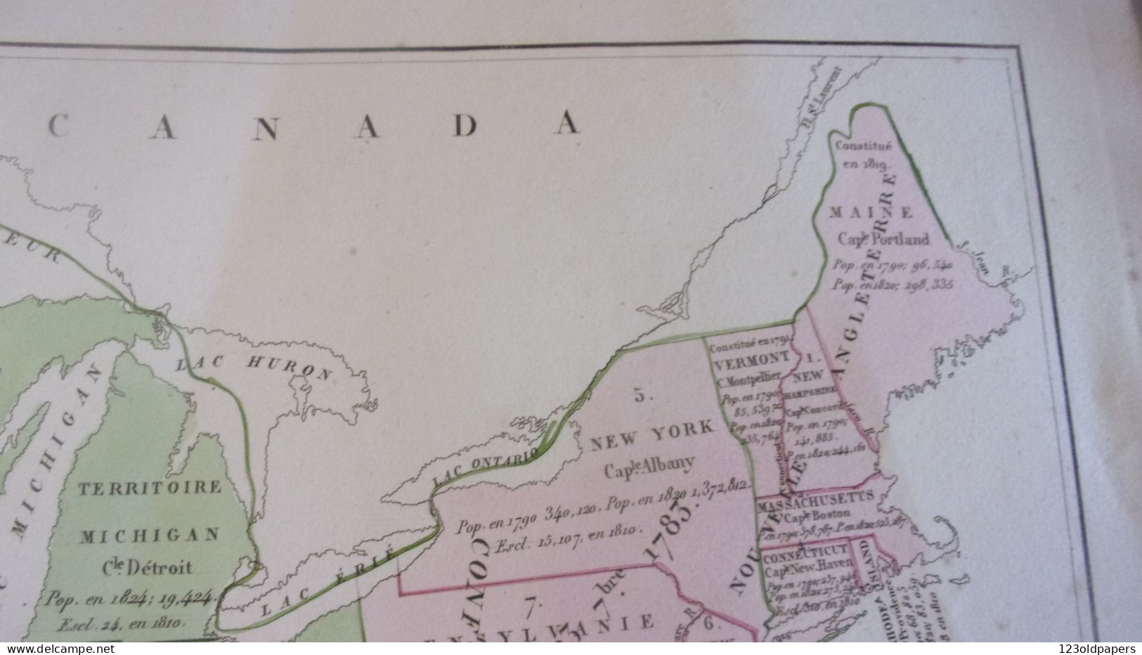
This is unique publisher's proof of Jean Alexandre Buchon's important map of the United States, intended to be included in his Atlas geographique, statistique, historique et chronologique des deux Ameriques (Paris, 1825). It was evidently made for the publisher of the work, J. Carez, and the manuscript notes, quite possibly in the hand of Buchon, detail of how the map was to be colored. The original 13 states, plus Vermont, were to take on a pink hue; Florida (acquired by the U.S. from Spain in 1819) was to assume on a teal hue; the states and territories in the Trans-Appalachian west (unorganized land conferred to the U.S. by Britain in 1783) were to be in a green hue, and the western territories, beyond the Mississippi, were to assume a yellow hue. The nature of the coloring was integral to the purpose of the map. The splotches and irregular lines of color around the map were intended to test the appearance of the color as it was applied to the paper.
Bouchon's map is interesting in that it shows the development of the United States two generations after the American Revolution. Each of the states and territories are marked, naming their capitals, noting the dates of their entry into the Union and giving statistics as to their populations and geographic size. By 1825, many of the lands east of the Mississippi had already been divided into states, although the Northwest Territory still exits. The vast Louisiana Territory, purchased from France in 1803, occupies the vast lands between the Mississippi and the Rockies, although the states of Louisiana and Missouri have been constituted. The Oregon Territory is shown occupy the Pacific Northwest, although the ownership of this region was officially still shared between the United States and Britain.


 Scopri l'agenda dei collezionisti!
Scopri l'Agenda
Scopri l'agenda dei collezionisti!
Scopri l'Agenda